

TERRA-MIX - ein steirisches Unternehmen mit Spezialisierung auf Bodenverdichtung und -stabilisierung
Together with the company ARTEMES, a GPS-supported software was developed that is perfectly adapted to the customer and allows the excavator driver to approach and process any points with centimetre precision.
TERRA-MIX is a globally active company based in Wettmannstätten, Styria/Austria, and specialises in soil compaction and stabilisation. However, in order to survive in international competition, simply using existing technologies is not enough. One has to improve them or even develop new ones.
TERRA-MIX is a showcase company here and has developed a new, extremely innovative method for the compaction of soils with impulse compaction. In this process, a hammer weighing several tonnes is repeatedly lifted and dropped by a correspondingly powerful excavator. The enormous forces acting on the soil achieve a compaction that can be detected down to a depth of eight metres. Recently, a drilling tool can be mounted on the same machine, which immeasurably increases the possibilities of making non-load-bearing soils load-bearing.
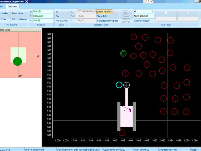
Together with the company ARTEMES, software was developed that is perfectly tailored to the customer's needs. In the excavator, the driver operates with GPS-supported software that allows him to approach and process any points with centimetre precision. Compaction plans are designed by the geotechnical team and can be imported directly into the software. The software processes all relevant sensors of the plant and calculates the parameters necessary for the statics.
Both specifications and results are synchronised globally via a virtual network so that the project management has constant access to the current project data.
GPS-supported software
Figure 1: GPS location of the compaction points
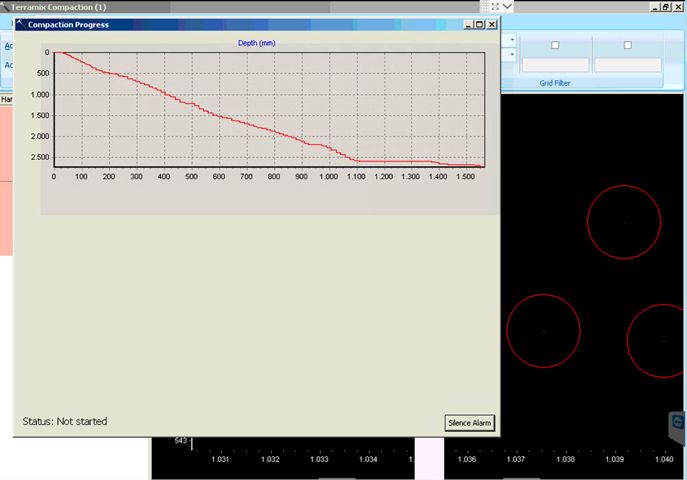
Figure 2: The compaction process can be visualised via the software.
Innovative solutions require innovative partners!
Visit us and make your own business special.